|
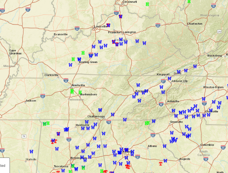
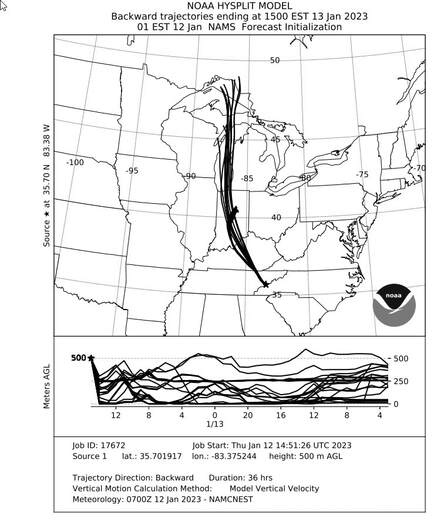
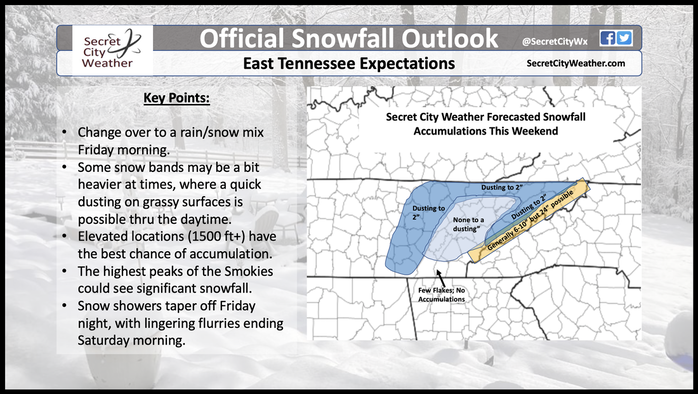
Here are the storm reports received across East Tennessee yesterday, where quite a bit of wind damage was reported. The NWS did issue two tornado warnings: one across South Knox and into Dandridge and the other just east of there. As of now, no reports of a tornado but there certainty was some interesting rotational couplets that posed concern on radar. Anyway, we've flipped scripts and dropped in temperatures where wintry precipitation is now in the forecast. Some have seen some light snow showers today, but those will become more widespread this afternoon. Highs today will stay fairly uniform, in the upper 30s to near 40 in the valley. Looking at where this airmass and moisture is coming from, a HYSPLIT run shows us just that. From the Great Lakes area, moisture will filter through in the form of snow. Pretty neat to see moisture fed by the Great Lakes across East Tennessee, right? This will be in the form of snow for many, where light accumulations are possible. Looking at our official snowfall map, snowfall accumulations will vary. Because the snow bands moving in from the northwest will be very streaky, some locations will have better potential than others depending on where those set up. Nonetheless, the highest elevations (where temps stay near to below freezing) will have the greatest chance. A winter weather advisory has been issued for the Plateau and Foothills, while a Winter Storm Warning is in place across the Smokies. Working through the weekend, high pressure returns. This will allow for drying and gradually warming temperatures. Highs will climb to around 50 by Sunday, before shower chances creep back in MLK day and into Tuesday. After a quick cool off today and tomorrow, highs return to the 60s by next week. Pre-recorded for 5pm weather broadcast
0 Comments
Leave a Reply. |
Your trusted source for everything weather in East Tennessee.
Social Media
|


