|
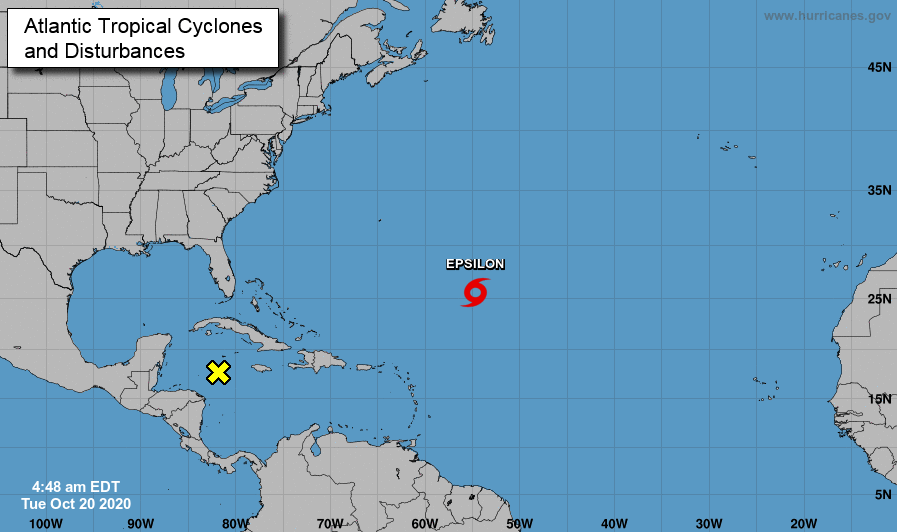
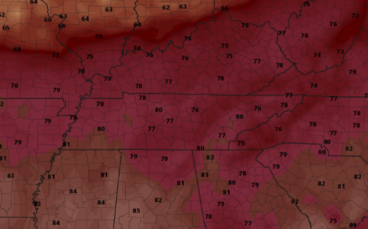
We are seeing some patchy fog hanging around parts of the valley this morning, so account for a little extra time to work & school. A look into the Tropics shows a familiar seen this year: more activity. Tropical Storm Epsilon is currently in the mid-Atlantic and will banana north and east with time. Epsilon does not pose a threat to the US in the days ahead. However, an area of low pressure sits to the east of Mexico bringing the potential for weaker activity in the days ahead. For now, this system has a less than 40% chance of forming in the next 48 hours. With high's today topping out near 80, the warm trend will continue for Wednesday and Thursday. A look at high's tomorrow shows temperatures nearly 10 degrees above average. The same can be said for Thursday as well before cooler air arrives with rain chances into the weekend. A high pressure system is placed just to our east. This is what is keeping dry air in place for East Tennessee and gives the weird orientation of the system to our north. This is also why we have been so warm and will continue to be tomorrow and Thursday. The return flow of the ridge is funneling in warm southern air. As we work ahead, showers to our north (Kentucky) will wade out, leaving sunny skies Wednesday and Thursday. By Friday, a new system arrives bringing the potentials for isolated showers through the day and into Saturday. That will wrap it up for today, but as always, thank you for choosing Secret City Weather. Pre-recorded for 5pm show
0 Comments
Leave a Reply. |
Your trusted source for everything weather in East Tennessee.
Social Media
|


